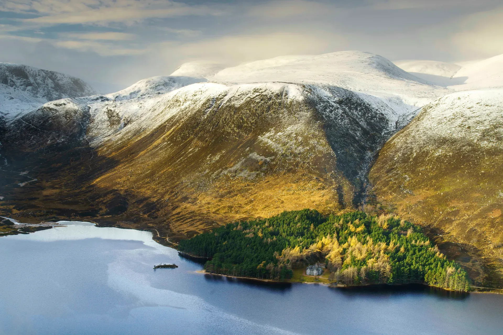
Cairngorms National Park stretches across 4,528 km² of the eastern Scottish Highlands — the UK's largest national park, holding five of Britain's six highest mountains and a quarter of its rarest wildlife.
Cairngorms National Park covers 4,528 km² of the eastern Scottish Highlands, spread across Aberdeenshire, Moray, Highland, Angus and Perth & Kinross. That makes it the largest national park in the UK, and the Cairngorm massif at its centre is the reason it exists: a huge arctic-alpine plateau holding five of Britain's six highest peaks, ringed by ancient Caledonian pine forest, heather moorland and glens. Hub towns — Aviemore, Ballater, Braemar, Grantown-on-Spey, Kingussie, Newtonmore and Tomintoul — sit in the straths around the edges, and about 18,000 people live inside the boundary year-round.
The park is one of Britain's strongestholds for wildlife. It shelters 25% of the UK's rare and endangered species, including capercaillie, Scottish wildcat, red squirrel, ptarmigan, golden eagle and freshwater pearl mussel. There are 55 Munros to climb, and all three of the region's great rivers — the Spey, Dee and Don — rise here. Abernethy Forest and Mar Lodge Estate are national nature reserves, and the Cairngorm Lochs have been a Ramsar wetland since 1981.
What you actually get is unusual for a national park: no entrance fee, no gates, open access to most of the land under Scotland's right to roam. In one trip you can ride the UK's highest funicular to 1,097 m, walk a flat 5 km loch circuit through pinewoods, ski a 30 km network of runs in the northern corries, and still be back in Aviemore for dinner. It's a wild mountain range and a working, farmed landscape at the same time — tourism accounts for roughly 80% of the local economy, with 1.9 million visits recorded in 2018.
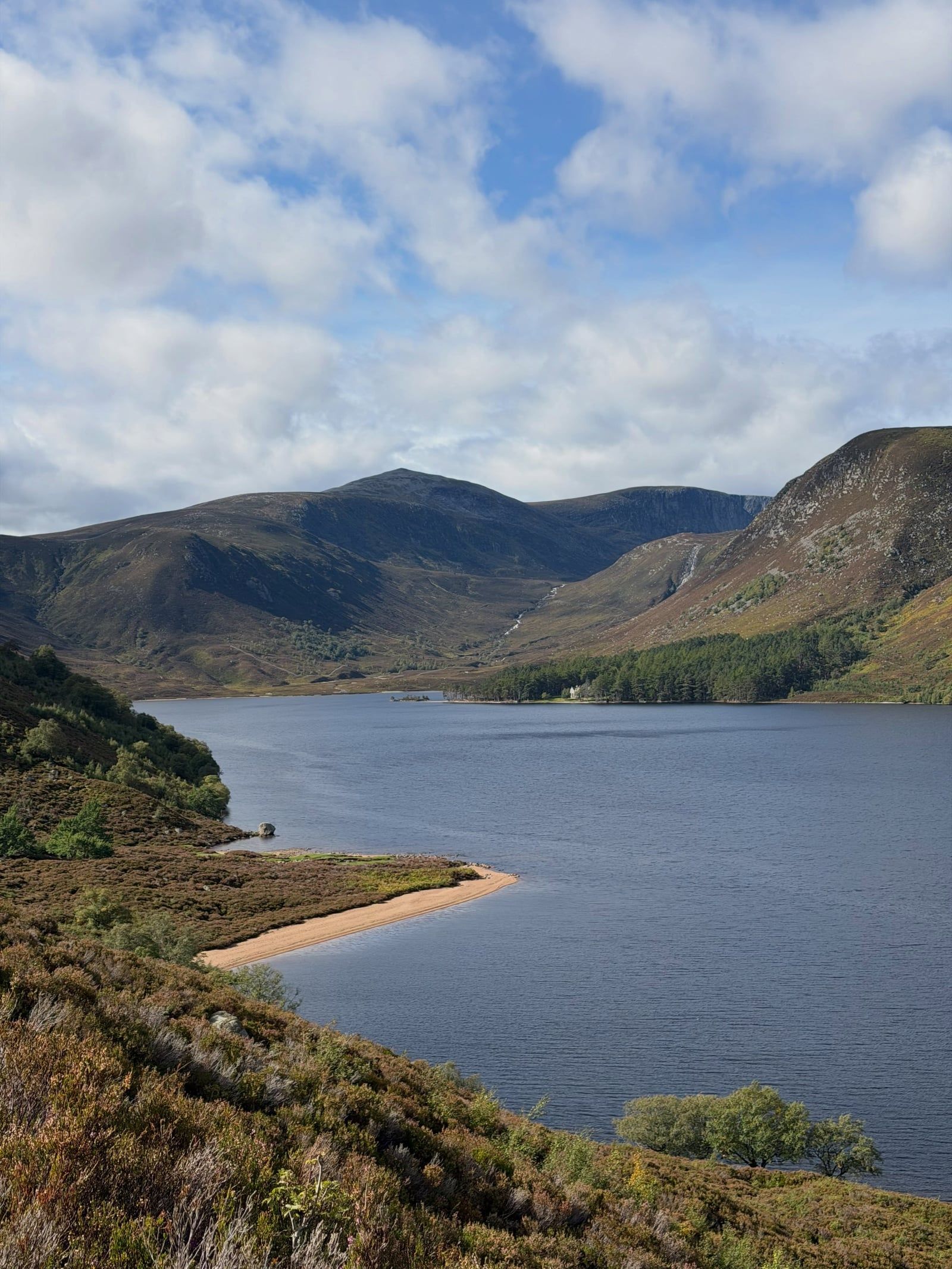
The rocks under the Cairngorms are old even by Highland standards. Dalradian sediments were laid down between 800 and 600 million years ago, then, around 427 million years ago, molten granite forced its way up through them in several large plutons. Ice ages then spent millions of years planing the granite into the shape you see now: three broad plateaus sitting at 1,000–1,200 m, with domed summits and free-standing tors scattered across boulder-strewn tops. No humans witnessed any of this. When people finally arrived, they found a landscape more like Arctic Norway than anything else in Britain.
Recorded history in the glens is mostly military and royal. After the 1715 Jacobite rising, the British army built Ruthven Barracks near Kingussie in 1719 — two three-storey blocks that still stand above the A9, free to wander around at any time. Later, Queen Victoria put the area on the fashionable map. She climbed Ben Macdui, the park's highest summit, in 1859 at the age of 40, and her Deeside home at Balmoral drew high society to the eastern glens every summer, a pattern that continues whenever the Royal Family is in residence.
Formal protection came late. The Cairngorm Lochs were designated a Ramsar wetland on 24 July 1981, and after the National Parks (Scotland) Act 2000, the Scottish Parliament moved quickly: Loch Lomond and The Trossachs became Scotland's first park in 2002, and the Cairngorms the second in 2003 — already the largest in the UK. In 2010 the boundary was extended into Perth and Kinross, pulling Blair Atholl and the southern hills inside.
The park now balances 1.9 million annual visits (2018 figure) against fragile habitats. In 2025 the Cairngorms National Park Authority introduced the UK park sector's first fire-management byelaw, banning all fires and barbecues between 1 April and 30 September after a run of devastating wildfires. It's a working park too: farms, sporting estates and distilleries operate across the same land the hikers cross.
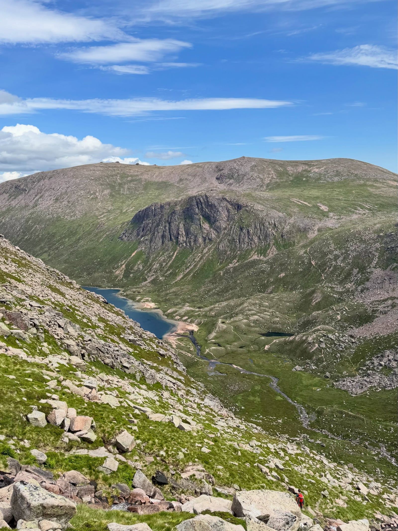
The Cairngorm massif is essentially three plateaus stacked around a high core, sitting between 1,000 and 1,200 m with rounded granite summits pushing toward 1,300 m. Ben Macdui tops out at 1,309 m — the second-highest mountain in Scotland and the British Isles after Ben Nevis — while Cairn Gorm itself (1,244 m) gave the whole range its name. The summits are littered with tors, free-standing granite pinnacles left behind when ice stripped the surrounding rock away. The granite is roughly 427 million years old; the Dalradian rocks it punched through are older still, deposited 800–600 million years ago.
What makes the range strange is the climate it creates. The plateaus form a tundra-like arctic-alpine environment that more closely resembles Norway's Hardangervidda than anywhere else in Britain, with snow patches that can persist into summer. Ptarmigan turn white here in winter, as they do in the Arctic. And the weather is genuinely dangerous: it can flip from sunshine to storm within an hour, even in July, and hypothermia is a real risk above 1,000 m in any month. There are no easy exits off the plateau once you're on it.
Around the massif, the terrain softens into the straths — broad glens holding the Spey, the Dee and the Don, all three of which rise inside the park. Remnants of the ancient Caledonian pinewood survive at Rothiemurchus and Glenmore, home to red squirrels, crested tits and crossbills. North of Strathspey, the Monadhliath hills roll between 700 and 950 m. The A9 road and the Highland Main Line railway both thread through the park's waist at the Pass of Drumochter, which is how most visitors arrive.
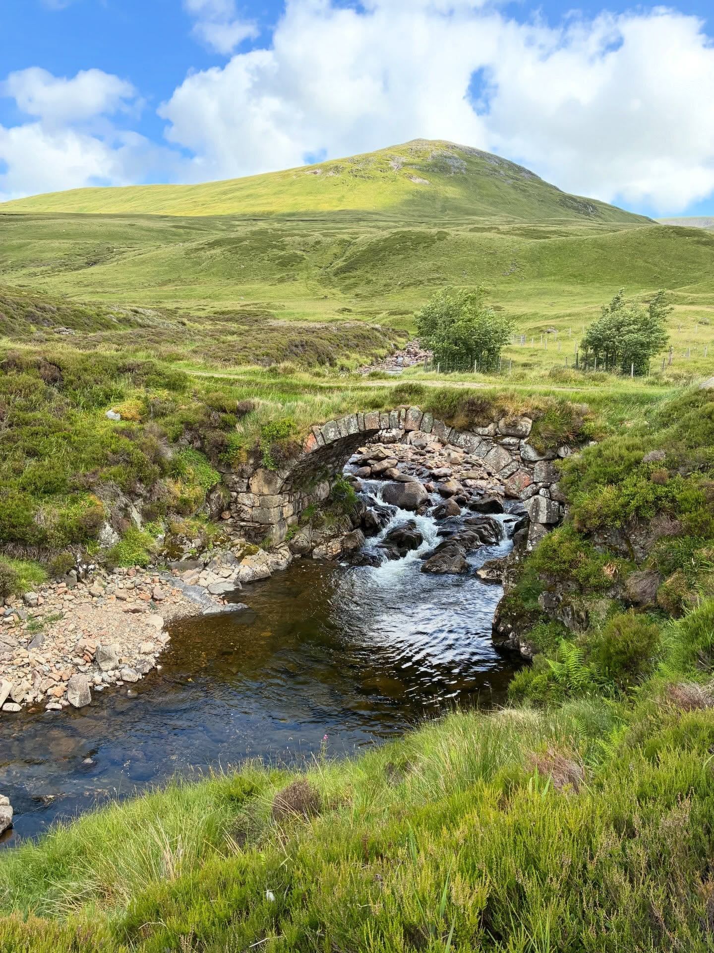
The park's Gaelic name, Pàirc Nàiseanta a' Mhonaidh Ruaidh, keeps an older description alive: Monadh Ruadh, the red hills, a nod to the pinkish granite of the massif — and a deliberate contrast with the Monadh Liath, the grey hills, just across Strathspey. Gaelic place names still map the glens, and the language remains part of the area's identity alongside the farming and estate traditions that have shaped the land for centuries.
Royal Deeside is the park's most famous cultural thread. Queen Victoria's 1859 ascent of Ben Macdui and her love of Balmoral fixed the eastern Cairngorms in the national imagination, and the castle between Ballater and Braemar still opens its grounds and ballroom to the public in season — though it closes whenever the Royal Family moves in, so check before you travel. Ben Macdui carries its own folklore too: Am Fear Liath Mòr, the Big Grey Man, a legendary presence reported on the summit since the 19th century.
For the 18,000 people who live here, the park is a workplace before it's a playground — farmland, sporting estates, distilleries and small tourism businesses, with tourism generating roughly 80% of the local economy. Speyside's whisky industry depends on the rivers that rise on the plateau. The Highland Folk Museum at Newtonmore preserves the social history of exactly these communities, and heritage steam trains still run from Aviemore through the Speyside pinewoods on the Strathspey Railway.
The Cairngorm funicular climbs 2 km from the 635 m Base Station to the Ptarmigan Top Station at 1,097 m in 5–8 minutes. At the top sits the UK's highest restaurant, over 1,065 m above sea level.
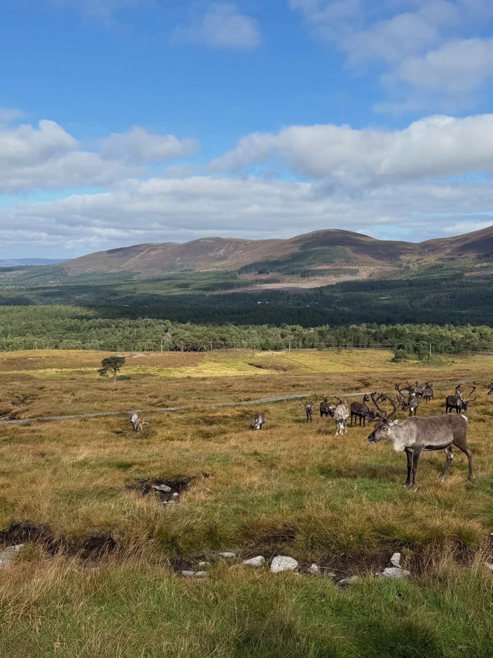
Britain's only reindeer herd lives here, and you can help feed them at the Cairngorm Reindeer Centre near Aviemore.
The park contains five of the UK's six highest mountains, including Ben Macdui at 1,309 m — second only to Ben Nevis in the whole British Isles.
Around 25% of the UK's rare and endangered species live in the park, from Scottish wildcat and capercaillie to freshwater pearl mussel.
The plateau is Britain's most arctic environment, and snow patches on the high tops can persist well into summer. Spring walkers heading for Ben Macdui are advised to carry an ice axe and crampons.
Loch Morlich, in Glenmore Forest Park, has a sandy beach and a watersports centre — a rare thing for a loch sitting high among mountains.
In 2025 the park introduced the UK park sector's first fire-management byelaw: all fires and barbecues are banned park-wide from 1 April to 30 September, with fines up to £500.
It's the UK's largest national park, covering 4,528 km² of the eastern Scottish Highlands across five council areas. At its centre is the Cairngorm massif, an arctic-alpine plateau with five of Britain's six highest peaks, surrounded by Caledonian pine forest, moorland and glens. About 18,000 people live inside the park, making it a working landscape as well as a protected one.
Yes. There's no entrance fee, no gates and no set hours — most of the park is open access land under Scotland's right of responsible access, 24/7. You only pay for optional extras like the Cairngorm Mountain funicular (£17.95 adult booked online in advance, £19.95 on the day) or car parking, such as £4.50 per day at Loch an Eilein.
Ben Macdui, at 1,309 m (4,295 ft), is the highest summit in the park and the second-highest mountain in Scotland and the British Isles after Ben Nevis. Cairn Gorm itself (1,244 m) gave the range its name but isn't the tallest. The park contains 55 Munros in total.
The Scottish Parliament created the park in 2003, under the National Parks (Scotland) Act 2000 — Scotland's second national park after Loch Lomond and The Trossachs (2002), and the UK's largest from day one. The boundary was expanded into Perth and Kinross in 2010.
Yes. Under the Land Reform Act 2003 you can camp on most unenclosed land, provided you camp lightly, keep groups small and take all litter home. Note that from 1 April to 30 September all fires and barbecues are banned park-wide under the 2025 fire byelaw, so cook on a stove. Registered campsites are exempt from the fire ban.
The season usually runs from December through April, with the most reliable snow in March and early April. There are over 18 miles (30 km) of runs, 13 lifts and a freestyle park, and snow cannons supplement natural snowfall. February half-term is the busiest period, so book railway and lift capacity ahead.
You can ride the funicular year-round (weather permitting) to the Ptarmigan Top Station at 1,097 m, but outside the snowsports season a conservation plan bars passengers from leaving the Top Station building — only the restaurant, terrace, shop and exhibition are accessible. Walkers must start from the Base Station, and large rucksacks aren't allowed on the railway.
Take a direct train to Aviemore — about 2h 56m from Edinburgh Waverley on roughly 12 daily services, or 30–40 minutes from Inverness. From Aviemore, the Stagecoach Aviemore Adventurer bus (route 30) runs seven days a week to Cairngorm Mountain with space for bikes and skis, stopping near Rothiemurchus for the Loch an Eilein walk. Coaches also connect the park with London, Edinburgh, Glasgow, Aberdeen and Inverness.
Two to three days based in Aviemore comfortably covers the funicular, the Loch an Eilein circuit, a glen walk and an attraction or two. One long day can squeeze in the Ptarmigan Top Station plus the loch walk. Serious Munro-baggers (55 to choose from) and Speyside whisky tourers often stay a full week.
May–June and September are the sweet spots: daytime highs of 12–17°C, long daylight (up to about 17.8 hours around midsummer) and fewer biting midges and people than July–August. Midges are worst in summer near still water and woodland; higher ground and breeze keep them down. Avoid November — the wettest month, around 17 rain days, with reduced hours at many attractions.
Browse verified tours with free cancellation and instant confirmation.
Find Tours